Soil Evaluation on your Property: Getting Ready Part 1
- mike5015
- Sep 23, 2019
- 2 min read
Updated: Oct 13, 2019
Where to build?
Visiting the property and having a look around to envision where you would like to build is a great first step. Step two: Once you have located your desired building site, you can place stakes, flags, or other markers at the corners of the proposed structure location. Some things to keep in mind:
Access will be needed from the nearby roadway; driveway location and cost; access to power utilities; keeping clear of very low, floodplain, or soggy areas. Meet with your builder to find out if they feel the location will work well, or invite them to help you select the best building site. Also note that placing a building site on the bank of a water body or the side of a cliff could well require that a pump system be included in the septic design, so ensuring ample space down hill of the building site is a wise decision.
SSC recommends a review of the county's Zoning Department’s building setback distances for smaller properties or when the building site may be located near a property boundary line – county zoning officials, as well as some surveyors and builders are very knowledgeable about these requirements. Those seeking to begin commerical projects should also visit the county's Planning & Zonning Department.
Property Boundaries
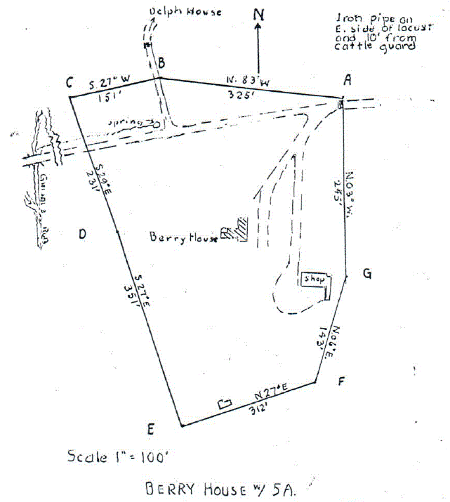
Having knowledge of actual property corners and boundary lines is very important. Having the property corners and boundary lines marked in the field is the best way to be certain of the limits of the property you own or wish to purchase, but is also very useful to your soil consultant, as they will need to be sure that the evaluated site is located within the property.
Soil consultants in Virginia also use property corners and boundary lines during preparation of site sketches, and later, for drafting CAD drawings that show where the septic system will be installed. This allows your soil consultant to show the local Health Department official that the septic and well systems are located on the property and that the required setback distances for the proposed well and septic systems have been achieved.
In some cases, the property boundary lines and corners may be easy to locate and a survey plat may even show that they run along a fence line, tree line, water body, etc., but for the many situations where boundaries and corners are not so obvious, SSC recommends having a surveyor locate and mark them in the field prior to scheduling a site & soil evaluation. Doing this can save time and provide valuable information about the property. Sometimes an older survey can include some inaccuracies - see the old survey sketch above - so again working with a licensed surveyor is often a good choice.
Visit our website to find service info, or scroll down to tour our blog's in-depth descriptions.


Comments